costa smeralda
from Porto Cervo to Porto Rotondo
Guests/Goods Pick up /Drop off Points
Hide MapIf you want to continue the navigation, please sign up
Request your temporary Access Code
This operational platform has been created to help yacht captains, yacht brokers, crew members, yacht agents and all people involved in the yachting industry to find in our DISCOVER SARDINIA section the right operational tool for cruising Sardinia. Nautica Assistance reserves the right to accept or decline the registration. Once accepted you will be receiving an access code with a validity of six months.
-
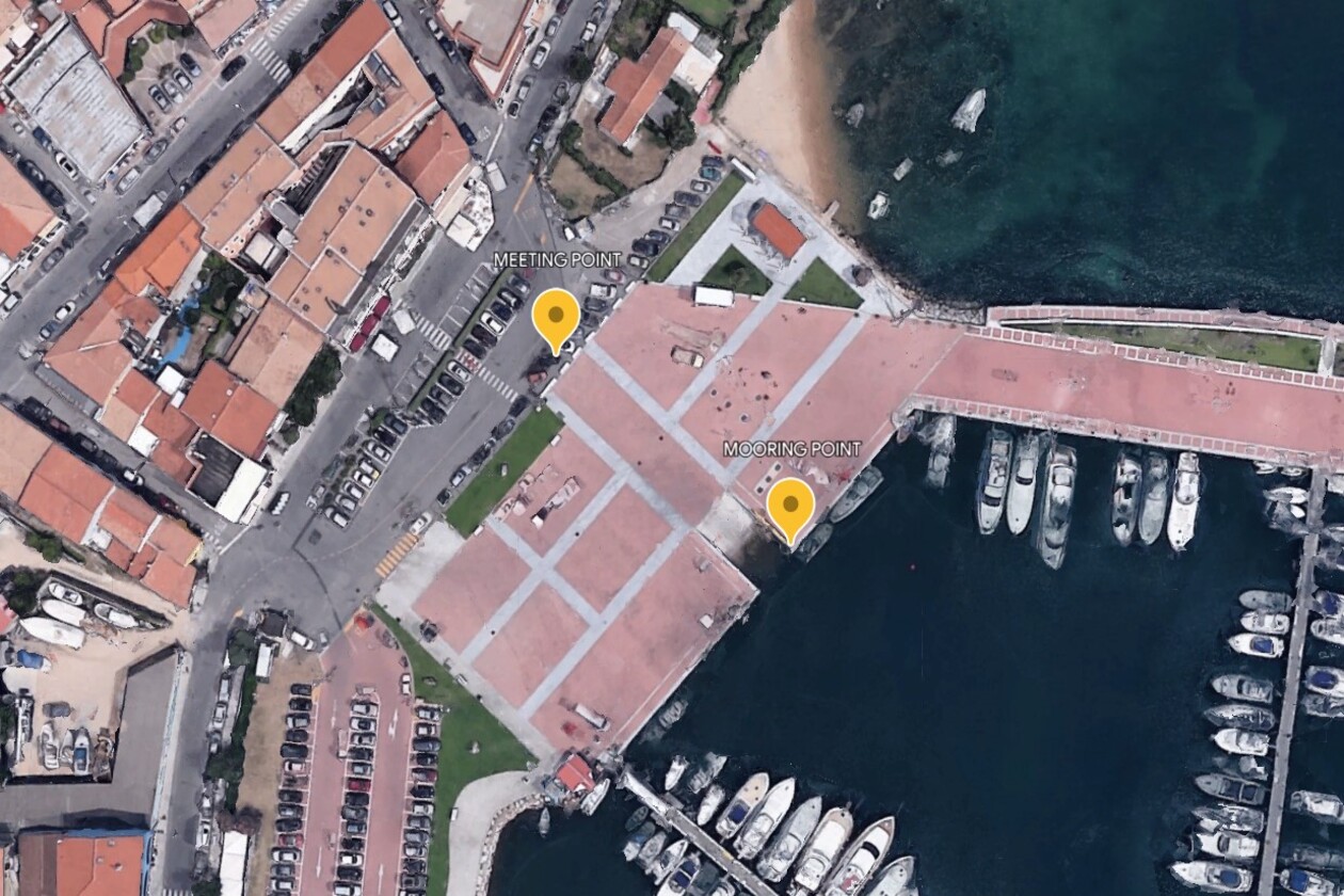
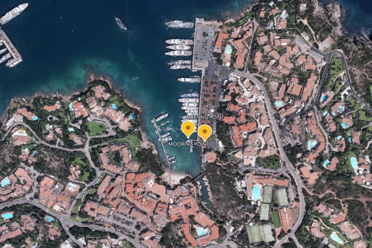
PORTO CERVO AREA - Cannigione Molo dei Fiori
×
PORTO CERVO AREA - Cannigione Molo dei Fiori
NAME: CANNIGIONE
DESCRIPTION:
Cannigione sits on the South side of the Golfo di Arzachena, and it has several docks all downtown the village. All docks are private apart from the concrete dock located on the Northern side of the port.
COORDINATES: 41° 06’ 34” N 9° 26’ 30” E
VHF CONTACT: NONE
DISTANCE FROM AIRPORTS:
Cagliari International Airport: 310 km (3 h 30 min)
Olbia International Airport: 30 km (31 min)
Alghero International Airport: 161 km (2H 10 min)
LANDING INSTRUCTIONS:
Enter the port from the South proceeding slow straight until the concrete dock, on your port side, where you will see the slipway. Vehicles will stop at the car park which is 20 mts distant.
-
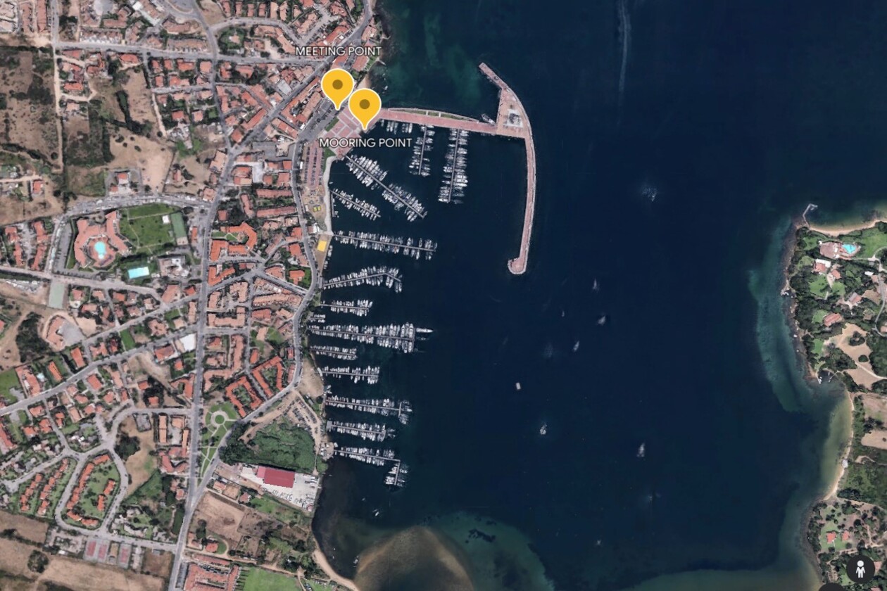
PORTO CERVO AREA - Poltu Quatu Marina dell'Orso Fuel dock
×
PORTO CERVO AREA - Poltu Quatu Marina dell'Orso Fuel dock
NAME: POLTU QUATU - MARINA DELL’ ORSO
DESCRIPTION:
Poltu Quatu is a private marina, very busy during the summer time. The marina allows tender to enter and dock by the old yard next to the fuel station as long as tenders are not left unattended.
COORDINATES: 41° 08’ 32” N 9° 29’ 42” E
VHF CONTACT: 9
DISTANCE FROM AIRPORTS:
Cagliari International Airport: 313 km (3 h 30 min)
Olbia International Airport: 33 km (36 min)
Alghero International Airport: 165 km (2H 11 min)
LANDING INSTRUCTIONS:
Approach the port from the North, take left after the main dock on your port side, pass the fuel station and moor at the concrete dock below the crane. Vehicles can reach the car park nearby.
-
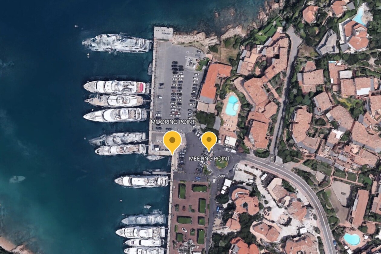
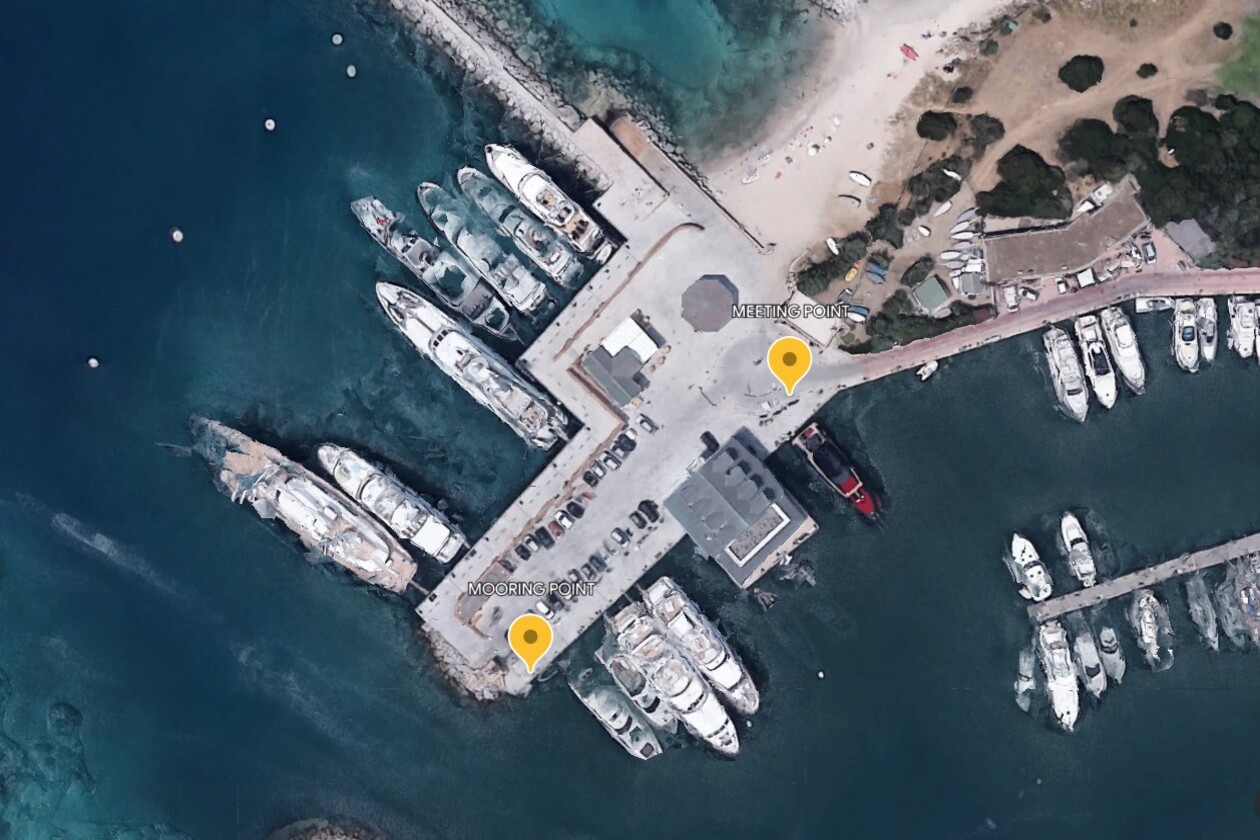
PORTO CERVO AREA - Porto Cervo Fuel Dock
×
PORTO CERVO AREA - Porto Cervo Fuel Dock
NAME: PORTO CERVO - FUEL DOCK
DESCRIPTION:
Porto Cervo Porto Vecchio is located to the east of the Marina on the south coast of the inlet: it consists of a long quay (where large pleasure boats dock), and a long floating pier.
COORDINATES: 41°08’05” N 9°32’12” E
VHF CONTACT: 9 - 16
DISTANCE FROM AIRPORTS:
Cagliari International Airport: 340 km (4 h 25 min)
Olbia International Airport: 34.5 km (35 min)
Alghero International Airport: 158 km (2h 15 min)
LANDING INSTRUCTIONS:
Enter the port from the East proceeding slow straight until the concrete dock on your port side, where you will see the fuel station. Vehicles will stop at the car park which is 20 mts distant.
-
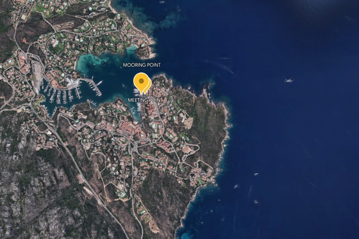
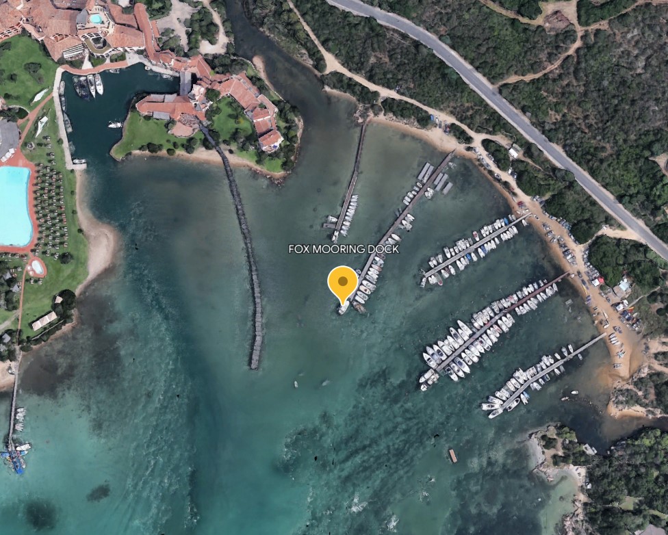
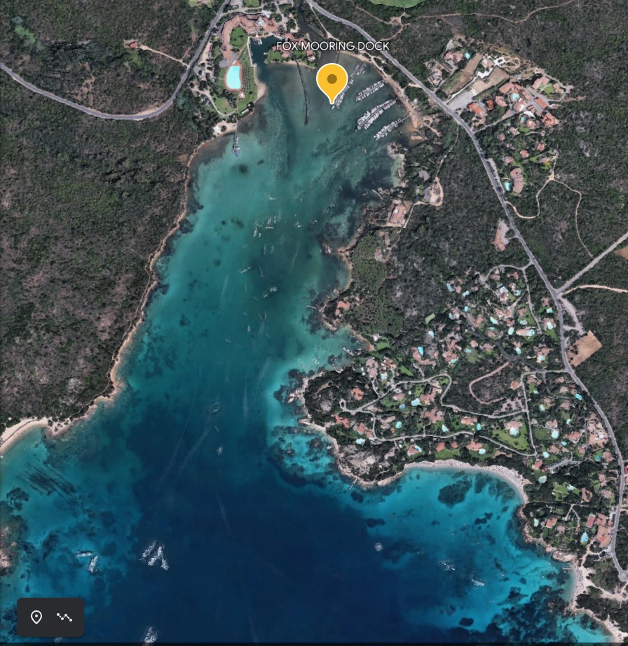
PORTO CERVO AREA - Cala di Volpe Fox Mooring dock
×
PORTO CERVO AREA - Cala di Volpe Fox Mooring dock
NAME: CALA DI VOLPE - FOX MOORING DOCK
DESCRIPTION:
Fox Mooring is a buoy camp located in the bay of Cala di Volpe. It’s a private buoy camp and access to the dock is possible upon request only for boats moored at the Fox Mooring buoy.
COORDINATES: 41° 05’ 19” N 9° 32’ 34” E
VHF CONTACT: VHF 15
DISTANCE FROM AIRPORTS:
Cagliari International Airport: 285 km (3 h 15 min)
Olbia International Airport: 27 km (32 min)
Alghero International Airport: 158 km (2h 10 min)
LANDING INSTRUCTIONS:
Enter the dock area from South proceeding slowly, leaving the Hotel on your port side. Fox Mooring dock will be on your starboard side. Vehicles will be parked at 50m from the dock.
-
PORTO ROTONDO AREA - Portisco Dock 0 Green Light
×
PORTO ROTONDO AREA - Portisco Dock 0 Green Light
NAME PORTISCO
DESCRIPTION Portisco Port is part of Golfo di Cugnana, at a short distance of Olbia Airport and Costa Smeralda, so main marinas like Porto Cervo and Porto Rotondo.
The green light is a perfect pick up/drop off point for goods and transfers.
Docks are private but it is still possible to book them. Bunkerage service is available too.
COORDINATES 41°01'58.8"N 9°31'34.1"E
VHF CONTACT CHANNEL 69
DISTANCE FROM AIRPORT
OLBIA airport 19 KM ( 25 min)
ALGHERO airport 151 KM (2 h 10 min)
CAGLIARI airport 281 KM (3 h 20 min)
LANDING INSTRUCTIONS
Enter port from South and proceed towards the Green Light to reach the first drop off point
-
PORTO ROTONDO AREA - Porto Rotondo Yacht Club
×
PORTO ROTONDO AREA - Porto Rotondo Yacht Club
NAME: PORTO ROTONDO YACHT CLUB
DESCRIPTION:
The operations among the yacht club docks are still depending from the Marina di Porto Rotondo.
COORDINATES: 41°01’46” N 9°32’37” E
VHF CONTACT: Ch 9
DISTANCE FROM AIRPORTS:
Cagliari International Airport: 275 km (3 h 15 min)
Olbia International Airport: 25,5 km (28 min)
Alghero International Airport: 263 km (2h 20 min)
LANDING INSTRUCTIONS: Enter the dock area from North proceeding slowly, leaving the Fuel dock on your starboard side, on your port side you will find the dock with the Yacht Club.
-
PORTO ROTONDO AREA - Porto Rotondo Marina Office
×
PORTO ROTONDO AREA - Porto Rotondo Marina Office
NAME: PORTO ROTONDO MARINA
DESCRIPTION:
The Marina at Porto Rotondo has always been able to win the approval and appreciation of international nautical tourism thanks to the ease of access to the berths, their safety and the surrounding environment. Outside the port, a quay has also been built that can accommodate large vessels.
COORDINATES: 41°01’45” N 9°32’35” E
VHF CONTACT: Ch 9
DISTANCE FROM AIRPORTS:
Cagliari International Airport: 275 km (3 h 15 min)
Olbia International Airport: 25,5 km (28 min)
Alghero International Airport: 263 km (2h 20 min)
LANDING INSTRUCTIONS:
Enter the dock area from North proceeding slowly, keeping the Fuel dock on your starboard side, and all the way around the waterbreaker you will find the P Rotondo Marina Offices
-
BAJA SARDINIA AREA - Phi Beach
×
BAJA SARDINIA AREA - Phi Beach
NAME: Phi Beach
DESCRIPTION: The dock of the PHI Beach club can be used only for guests drop off after contacting the Club at the VHF 9.
COORDINATES: 41°08'31.4"N 9°27'57.8"E
VHF: Ch 9
DISTANCE FROM AIRPORT:
Cagliari International Airport: 164 km (2 hrs)
Olbia International Airport: 36.5 km (45 min)
Cagliari International Airport 293 km (3.30 hrs)
LANDING INSTRUCTIONS:
Slowly approach the Phi beach dock and moore the tender just for the time of the drop off/pick up.
-
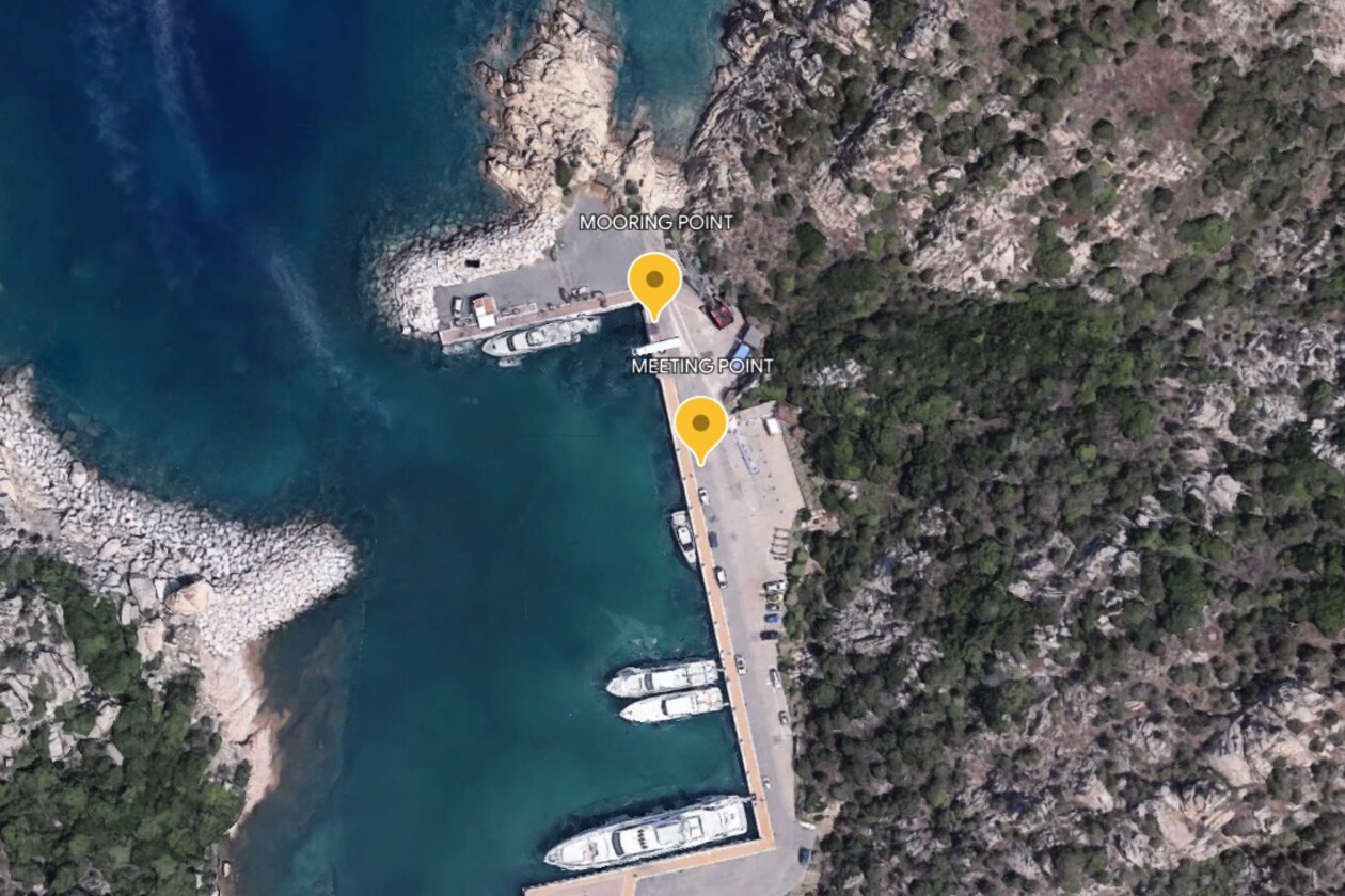
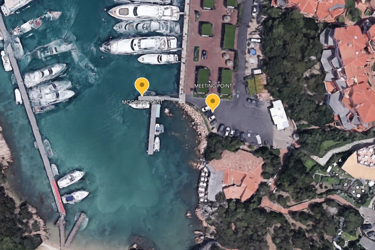
PORTO CERVO AREA - Porto Cervo Pescatore Dock
×
PORTO CERVO AREA - Porto Cervo Pescatore Dock
NAME: PORTO CERVO - PESCATORE DOCK
DESCRIPTION:
Pescatore dock takes its name from the most popular restaurant nearby and it is located at the end of the main dock of the old port.
COORDINATES: 41°08’05” N 9°32’12” E
VHF CONTACT: Ch 9
DISTANCE FROM AIRPORTS:
Cagliari International Airport: 340 km (4 h 25 min)
Olbia International Airport: 34.5 km (35 min)
Alghero International Airport: 158 km (2h 15 min)
LANDING INSTRUCTIONS:
Enter the port from the East proceeding slowly, turn left and proceed passing the fuel station and all yachts possibly moored on the same quay. At the very end of it you wil have a floating dock on your port side where you cannot keep the tender moored but only use to drop off and pick up. Vehicles can reach through the carpark at 10 mts distance from the dock.
-
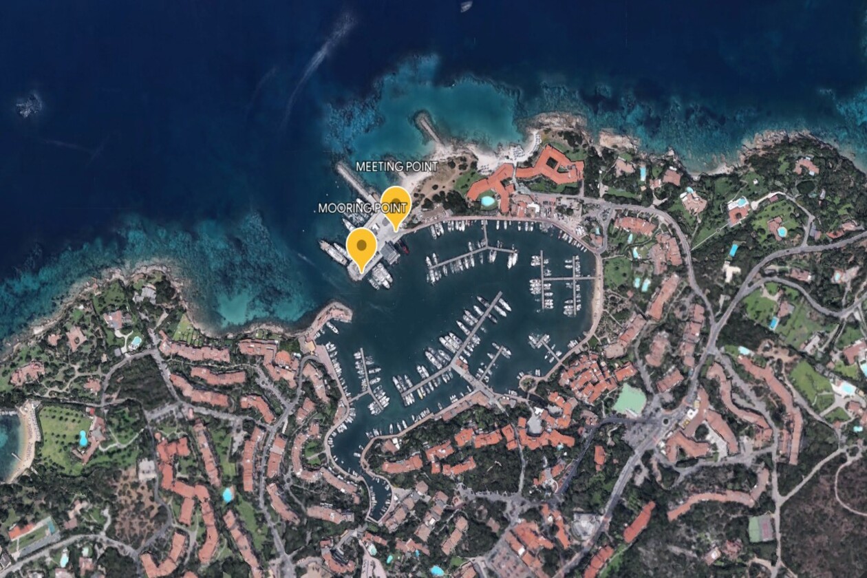
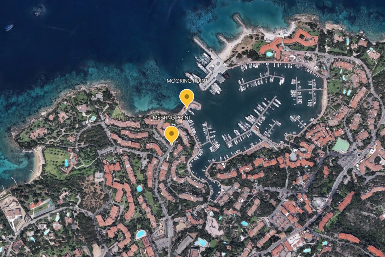
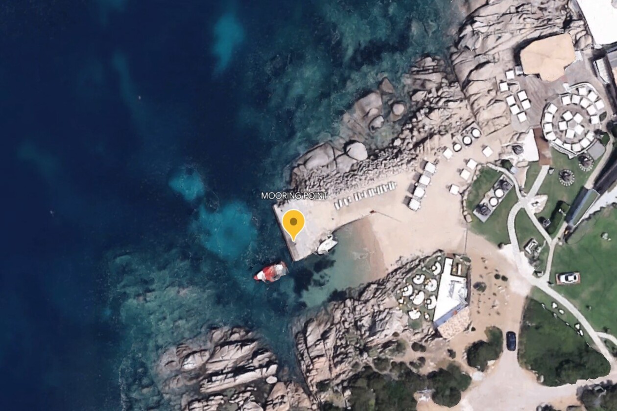
PORTO CERVO AREA - Romazzino Hotel Dock
×
PORTO CERVO AREA - Romazzino Hotel Dock
NAME: Romazzino Hotel Dock
COORDINATES: 41°05'55.7"N 9°33'59.6"E
VHF CONTACT: No VHF Ch available
DISTANCE FROM AIRPORTS:
Cagliari International Airport: 30 km (40 min)
Olbia International Airport: 155 km (2 hrs)
Alghero International Airport: 295 km (3,15 hrs)
LANDING INSTRUCTIONS:
After Hotel approval, the Hotel dock might be used for landing ashore.