s coast
from Muravera to Porto Pino
Beaches
Hide MapIf you want to continue the navigation, please sign up
Request your temporary Access Code
This operational platform has been created to help yacht captains, yacht brokers, crew members, yacht agents and all people involved in the yachting industry to find in our DISCOVER SARDINIA section the right operational tool for cruising Sardinia. Nautica Assistance reserves the right to accept or decline the registration. Once accepted you will be receiving an access code with a validity of six months.
-
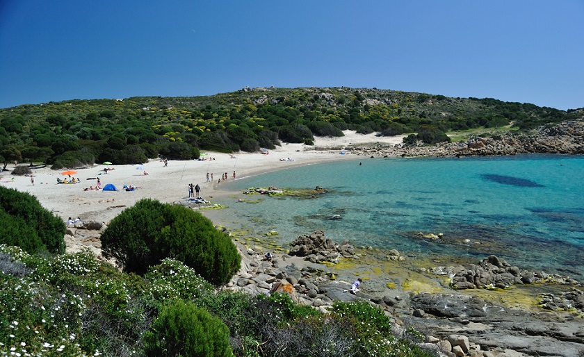
PORTO CORALLO AREA - Porto Corallo
×
PORTO CORALLO AREA - Porto Corallo
Coordinates: 39°26'08.7"N 9°37'56.5"E
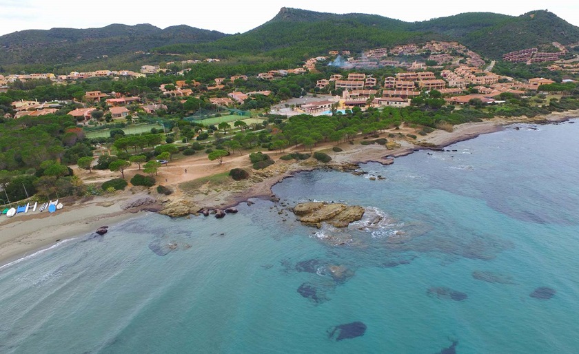
The beach of Porto Corallo has coarse sand and is surrounded by vegetation that reaches down onto the beach. The name refers to the presence of coral colonies, the gathering of which has gone on for many eras to create marvellous objects, especially in combination with gold. Behind the beach, a Spanish tower of the sixteenth century, aimed to sight the fleets of pirates that plundered the area. -
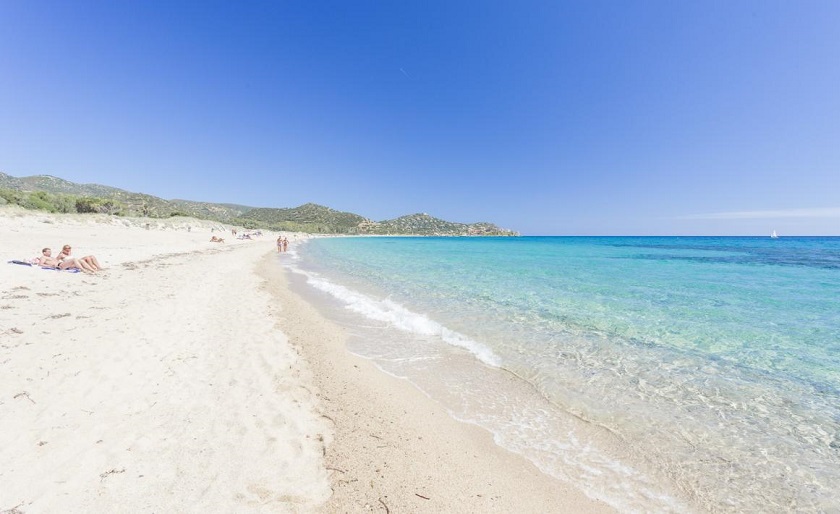
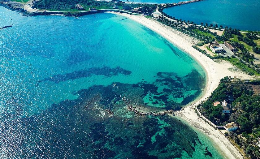
COSTA REI AREA - Le Saline
×
COSTA REI AREA - Le Saline
Coordinates: 39°15'12.9"N 9°34'32.2"E
The beach of Le Saline is about 8 km. It has a very soft, subtle and white, in some areas is golden. The water is very clear with low sea bottom. The long shore is punctuated by dark rocks creating small bays.
-
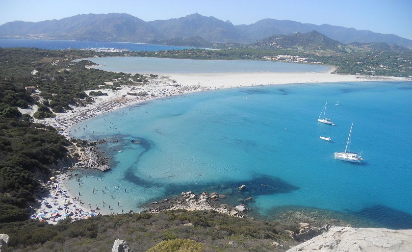
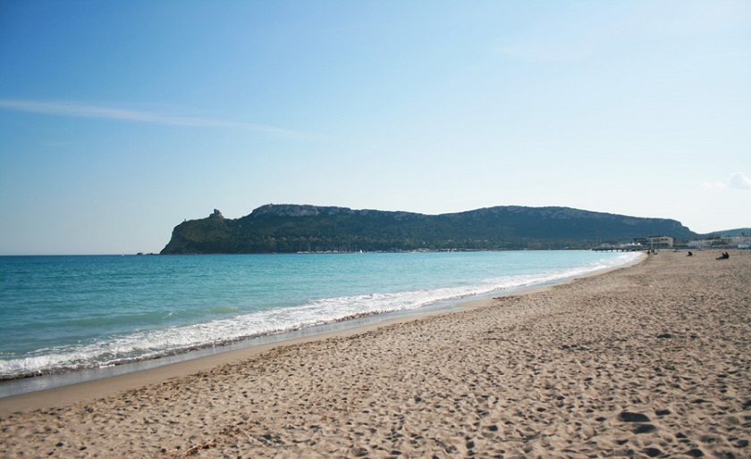
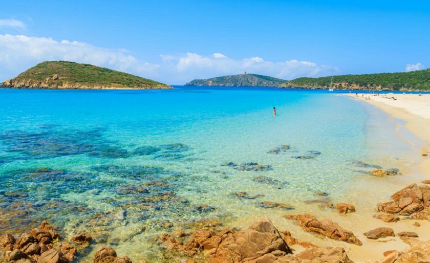
COSTA REI AREA - Piscina Rei
×
COSTA REI AREA - Piscina Rei
Coordinates: 39°24'9.265"N 9°57'5.118"E
This is one of the large beaches that make up the splendid Costa Rei coastline, defined by the prestigious Lonely Planet guide as one of the top ten beaches in the world. The brightness and softness of the sand, the crystal clear, shallow water, together with a few smooth rocks make you feel like you are bathing in a natural swimming pool. -
VILLASIMIUS AREA - Cala Sinzias
×
VILLASIMIUS AREA - Cala Sinzias
Coordinates: 39°11'34.4"N 9°33'46.8"E
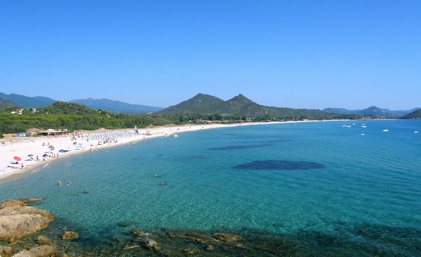
A small cove that opens its beauties beyond a thick eucalypt grove, protected by a promontory that offers a spectacular view of the turquoise horizon. The cove is a 2-km strip of fine, soft sand, deep and very white, incredibly clear seabed that drops quickly, and crystalline waters with various blue hues, marked by Goletta Verde of Legambiente as one of the cleanest in Sardinia. -
VILLASIMIUS AREA - Punta Molentis
×
VILLASIMIUS AREA - Punta Molentis
Coordinates: 39°08'01.1"N 9°33'23.5"E
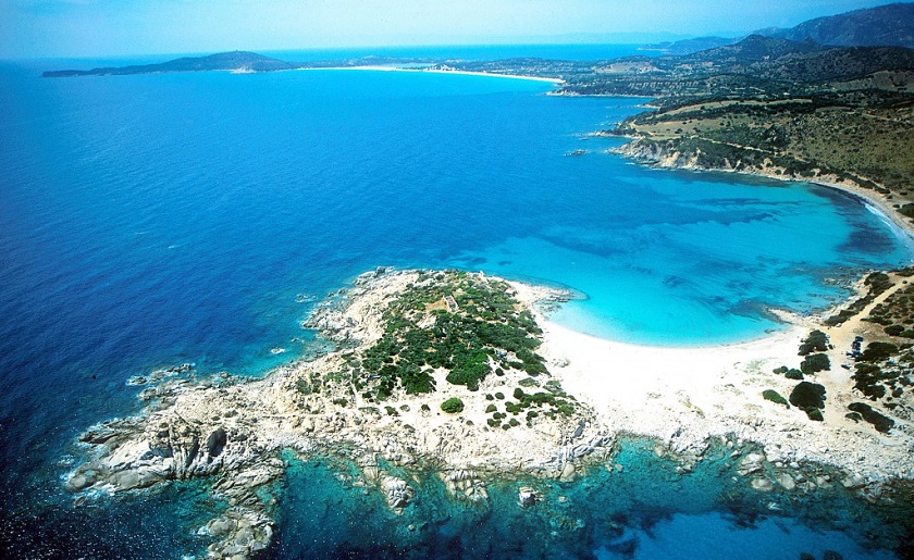
Punta Is Molentis is one of the most famous beaches in Villasimius. The azure and turquoise of the sea, the gleaming white of the beach, dotted with pink along the shoreline, and the green of the Mediterranean brush. Juniper, Cistus and Lentiscus frame this breathtaking sea view along with the granite rocks in the background and thick bushy vegetation all around. -
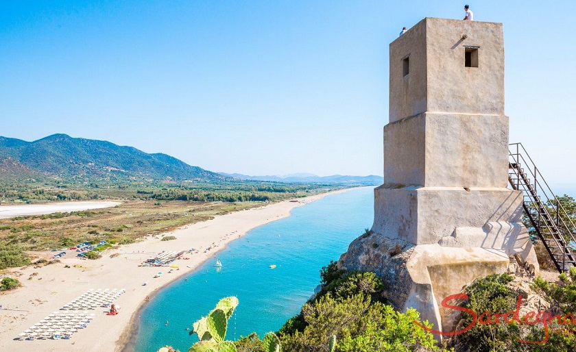
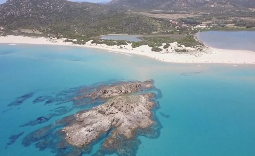
VILLASIMIUS AREA - Porto Giunco
×
VILLASIMIUS AREA - Porto Giunco
Coordinates: 39°06'50.2"N 9°31'05.1"E
Porto Giunco beach is located in the south-east side of Capo Carbonara, under the Porto Giunco Tower. Also known as the "two seas beach", it takes its name from the near pond and has the same characteristics of Simius beach such as wide and rich beach. This area is part of the Marine Protected Area of Capo Carbonara. -
VILLASIMIUS AREA - Geremeas
×
VILLASIMIUS AREA - Geremeas
Coordinates: 39°10′14.7″N 9°22′38.1″E
Thirty kilometres southeast of Cagliari amidst a fascinating landscape of unspoiled sand dunes, aquamarine inlets and strange rock formations lies Geremeas. Its two long sandy beaches, Spiaggia Geremeas and Spiaggia Cannesisa, are framed by a coastline of unparalleled beauty. The unusual juxtaposition of the spectacular sea and a spiffy village makes for an ideal blend of urbanity and nature. -
CAGLIARI AREA - Poetto
×
CAGLIARI AREA - Poetto
Coordinates: 39°12'38.8"N 9°10'19.0"E
The Poetto beach is truly vast, stretching as it does between Cagliari and Quartu Sant'Elena, and closed off at one end by the Sella del Diavolo Headland. As Poetto is backed by the Molentargius and Saline wetlands, standing on the beach it is often possible to spy the stately flight of flocks of pink flamingos, which have been safely nesting since 1993 in a protected oasis, one of a kind in Italy, sheltered from the road by a thick band of marsh reeds. The beach today has a full range of facilities: equipped lidos, kiosks, bars, restaurants, supermarkets, sea sports centres, a marina, a permanent fun fair and other attractions. -
CAGLIARI AREA - Cala Mosca
×
CAGLIARI AREA - Cala Mosca
Coordinates: 39°11'11.4"N 9°09'07.4"E
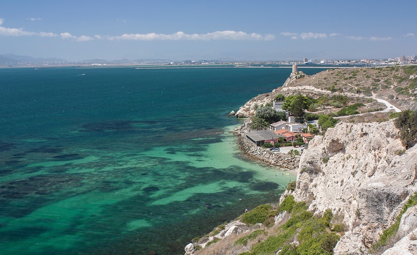
Calamosca is located in Cagliari, thus enjoying all the benefits of a city: the proximity of hotels, restaurants and cafes. In the locality of Calamosca, the beach of the same name presents itself with a seashore of coarse sand mixed with gravel of different sizes, bordered on the western side by a bluff and the promontory of Colle Sant'Elia, overlooked by a watchtower; the large hill has, over time, become famous as the Devil’s Saddle, from a legend that sees Lucifer, the devil, unsaddled by the angels. The beach of Calamosca, even if in an area set apart from the city, is not only visited by the inhabitants of Cagliari, but also discovered by tourists that are struck by the beauty of its shoals, full of light and shades of colour.
-
PULA AREA - Nora
×
PULA AREA - Nora
Coordinates: 38°59'15.5"N 9°00'48.6"E
The beach of Nora has white, mixed grain sand, enclosed by a rock formation, and its waters are shallow and thus ideal for families with children that can play on the shore without being in danger. The beach is near the archaeological zone of Nora, a city founded by the Phoenicians between the 9th and 8th centuries B.C., the most ancient in Sardinia. The archaeological area is situated at the foot of the promontory of Capo di Pula, in a position that allowed sure landing, whatever the type of wind. -
TUERREDDA AREA - Su Giudeu
×
TUERREDDA AREA - Su Giudeu
Coordinates: 38°53'00.1"N 8°51'44.4"E
Su Giudeu is, with any doubts, among the most beautiful beaches of the Mediterranean sea: really wide and flour-like sand, and marvellous waters. All around, the 20 metres high dunes are covered by ancient junipers modelled by the wind. On the right side of the beach, 150 metres far away from the sea, there is a big, dark reef where, in spring, wild goats use to herd. From the top you will enjoy an amazing sight on the whole coast of Chia. -
TUERREDDA AREA - Cala Cipolla
×
TUERREDDA AREA - Cala Cipolla
Coordinates: 38°52'43.57"N 08°51'17.18"E
Cala Cipolla is surrounded by pines and secular junipers. The panorama offered by this coastal line also includes the expanse of beaches, ponds and promontories that develop around the tower of Chia, with the whole remainder of the South Coast that stretches out to the west up to Capo Teulada. The beach has pure white sand and granite rocks of a thousand forms. Cala Cipolla is not particularly large but it boasts remarkable beauty owed to the crystal clarity of the sea and the highlights of the sand. The cove is enclosed by granite bluffs.
-
TUERREDDA AREA - Tuerredda
×
TUERREDDA AREA - Tuerredda
Coordinates: 38°53'41.1"N 8°48'50.0"E
Tuerredda has the right to be counted among the most beautiful beaches of Sardinia, and, according to many people, even among the top ten. White light sand, similar to talc, crystalline sea, Tuerredda is in a natural and still unspoiled scenery.