e coast
from Orosei Gulf to Muravera
Ports & Marinas
Hide MapIf you want to continue the navigation, please sign up
Request your temporary Access Code
This operational platform has been created to help yacht captains, yacht brokers, crew members, yacht agents and all people involved in the yachting industry to find in our DISCOVER SARDINIA section the right operational tool for cruising Sardinia. Nautica Assistance reserves the right to accept or decline the registration. Once accepted you will be receiving an access code with a validity of six months.
Already registered?
-
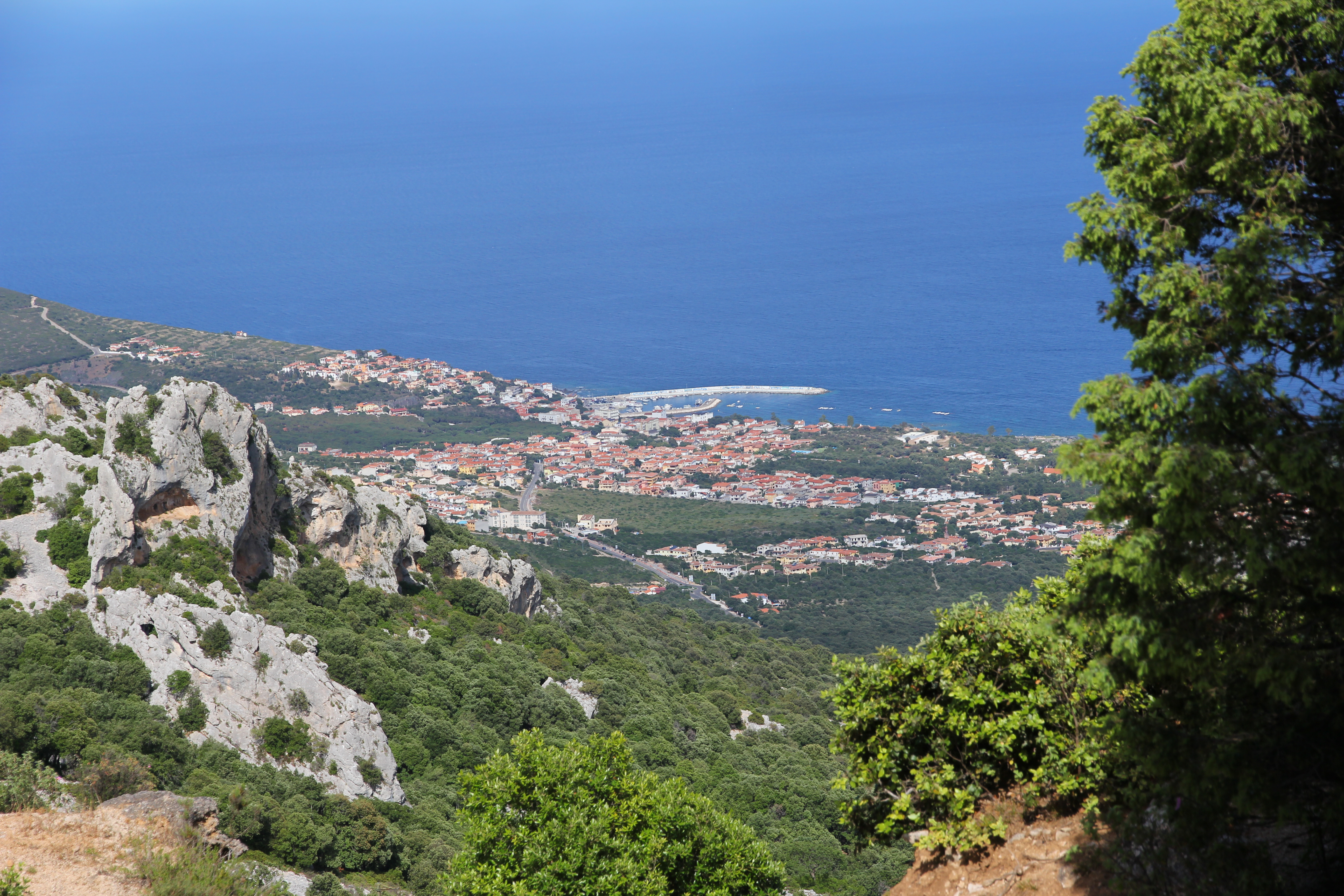
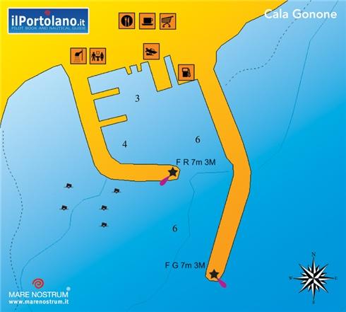
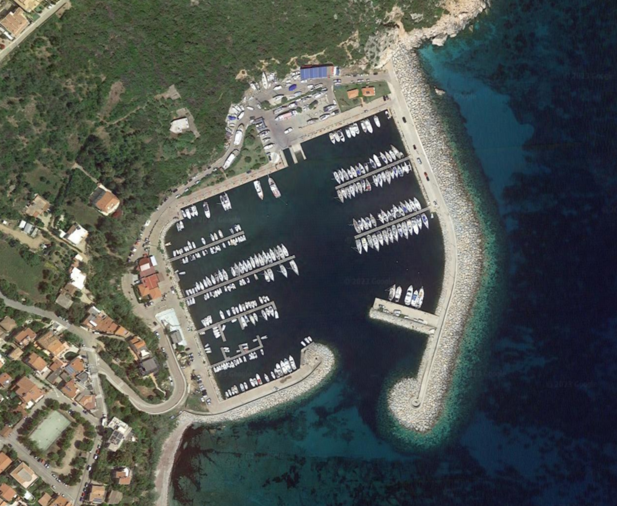
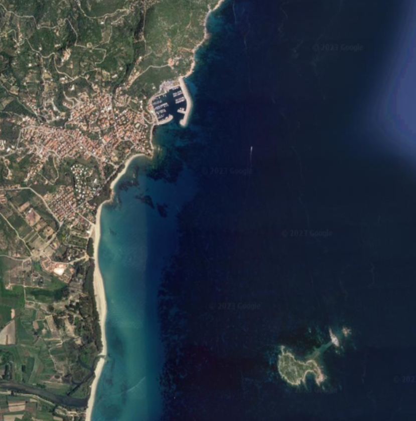
Marina di Cala Gonone
×
Marina di Cala Gonone
The port of Cala Gonone is the only staging area in the Gulf of Orosei, a territory of rare beauty on the east coast of Sardinia. Cala Gonone is the tourist district of the Municipality of Dorgali. It is located in the center of the Gulf of Orosei, a coastal stretch of rare beauty located in the central Eastern part of Sardinia.The famous Bue Marino caves and the beach of Cala Luna are a "must" for those visiting the island. The extraordinary scenery is completed by the small bays going to the southern end of the gulf (such as Goloritzè or Cala Mariolu) or the long sandy shores to the north. The seabed is both sandy and rocky, bay sheltered from West wind and Mistral.
USEFUL INFOS:
 40°16'59.5"N 9°38'15.6"E
  Maximum Lenght: 35 m, Maximum Draft: 4,5 m
 Services: Fuel, Electricity, Water, Wi-fi
 VHF: 16
 -
Santa Maria Navarrese Area - Marina di Baunei - Santa Maria Navarrese
×
Santa Maria Navarrese Area - Marina di Baunei - Santa Maria Navarrese
Porto Turistico di Santa Maria Navarrese is also identified as Port of Santa Maria Navarrese and it is hosted by the coastal tourist town with the same name. This marina offers its tourists the possibility of practising nautical sports and unwinding while admiring astonishing views by the Tyrrhenian Sea. It belongs to the municipality of Baunei in the province of Ogliastra, on the island of Sardinia, next to impressive shores with intense blue waters. Those who are passionate by nature will observe that maquis shurbland seascape is predominant in this place of history and culture.
USEFUL INFOS:
39° 59' 30" N 9° 41' 35" E Maximum Lenght: 43 m, Maximum Draft: 3 m Services: Fuel, Electricity, Water, Wi-fi, Laundry, Shower VHF: 74 -
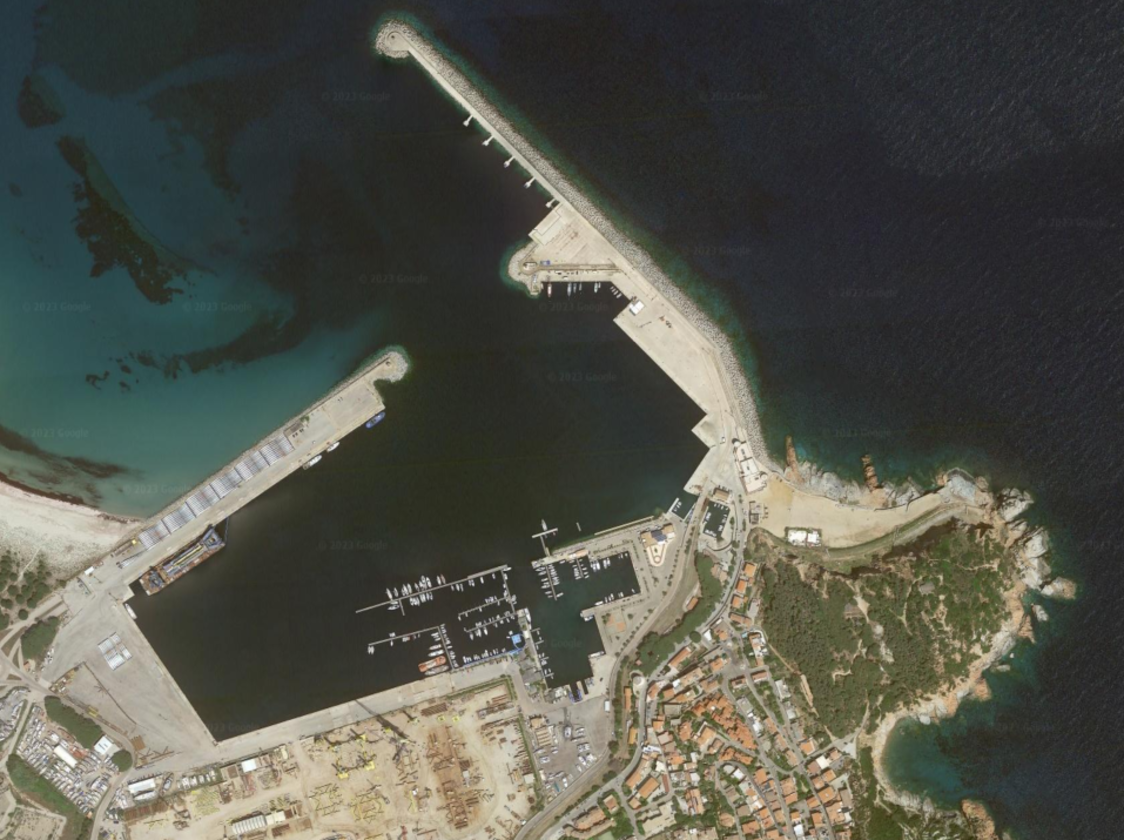
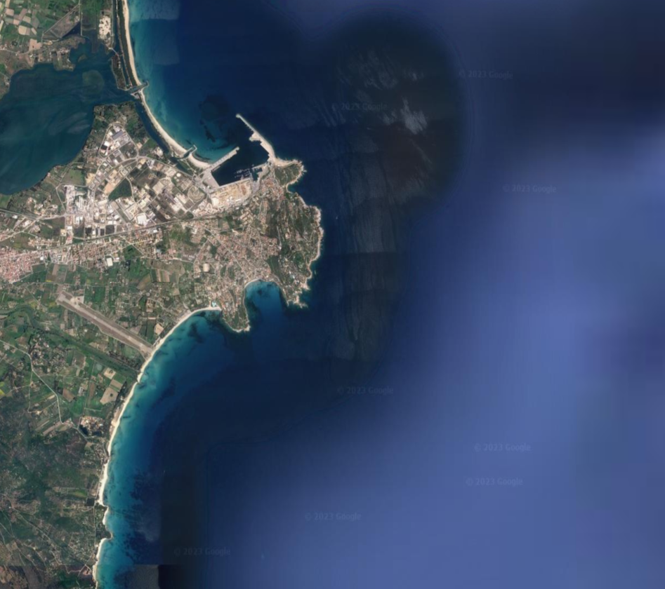
Arbatax Area - Marina di Arbatax
×
Arbatax Area - Marina di Arbatax
Marina di Arbatax is located inside the Port of Arbatax, to the south, to starboard of those who enter. It has over 650 berths. It can accommodate boats up to a maximum length of 85 meters. It has a depth of over 8 meters and very large maneuvering spaces for large boats.
USEFUL INFOS:
39° 56' 15" N 9° 42' 14" E Maximum Lenght: 50 m, Maximum Draft: 10 m Services: Fuel, Electricity, Water, Wi-fi, Shower VHF: 9 -
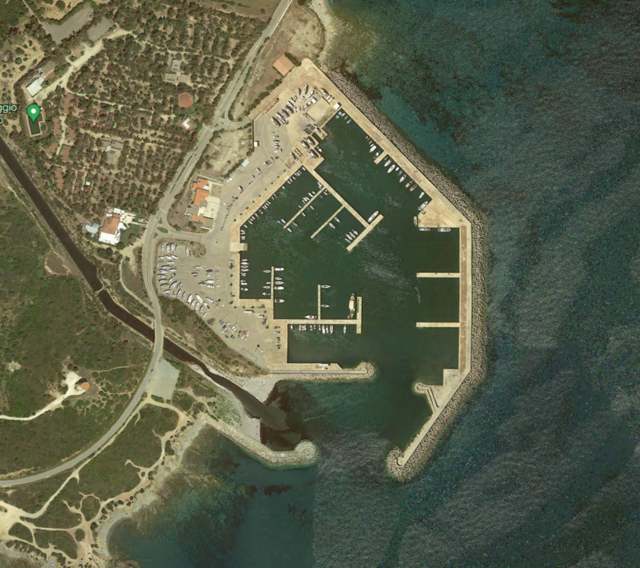
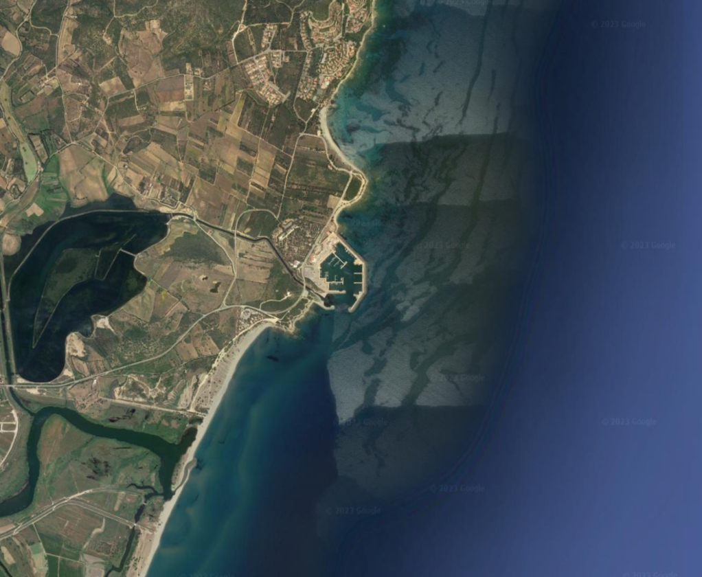
Muravera Area - Marina di Villaputzu Porto Corallo
×
Muravera Area - Marina di Villaputzu Porto Corallo
Situated between Capo San Lorenzo and Capo Ferrato, in the municipality of Villaputzu, south of Arbatax, the port consists of: An outer breakwater, An inner breakwater, A quay equipped with jetties Open 24 hours a day, the port offers mooring assistance. Boats coming from the South are required to pay attention to some sandbanks located about 250 metres from the beach. Boats coming from the North, on the contrary, have to keep a 1.5-mile distance from the islet of Quirra and the strecth of coast between Capo S. Lorenzo and Punta Su Tramatzu.
USEFUL INFOS:
39° 26' 26" N 9° 38' 19" E Maximum Lenght: 30 m, Maximum Draft: 4 m Services: Fuel, Electricity, Water, Wi-fi, Laundry VHF: 74